-
Case studies
Read about how Adtollo customers are using Topocad as their survey and mapping software.
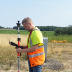 Municipal collaboration is strengthened with TopoDirekt
In Skåne, in the southern part of Sweden, three municipalities share their GIS work. Now, the cooperation is strengthened as the new surveying and mapping system TopoDirekt is introduced. In one of the municipalities, Hässleholm, it only took ten months to go from decision to a fully functioning system.
What is TopoDirekt?
Adtollo and Sokigo collaborate in a developed Surveying and mapping product where the key features are a strong own client in Topocad, a good adapter against databases, ISM, and a developed database model adapted to National specifications on Sweden.
 Drones facilitates keeping the map database of Vänersborg up to date
Working with a drone is very effective. That’s what Map- and measurement engineer Cecilia Eriksson, at Vänersborg municipality, deem. The drone compliments other equipment and makes it possible to easily update the map database when the demand on accuracy isn’t that high.
Easier steps from mapping to solids when Falun’s urban model in 3D is emerging
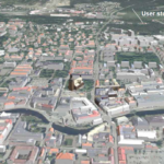
A 3D model of Falun is slowly growing. At the same time as aerial photos are being mapped, the information is transmitted directly to Topocad via the link to EspaCity. It simplifies the work for survey engineer Andreas Westman and his colleagues.
Drone images in Topocad enhance the quality of the drawing
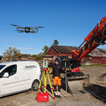 It’s about doing it right from the start. To get a base that complies with reality, survey technician Markus Johansson on Geodetik sends up a drone. With day-to-day pictures and surveyed objects, the design or drawing in Topocad is up-to-date. The number of errors are decreasing, Markus says.
Students at KTH learn 3D using Topocad
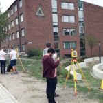 At KTH Royal Institute of Technology, the future civil engineers can broaden their knowledge in 3D and BIM. The course “Geodetic Survey Technology” mixes theory with laboratory work. Students increase their understanding of the 3D model and how it relates to the digital development. Here, Topocad is an educational tool.
Topocad – an important link in innovative AR technology
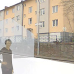 In advanced glasses, the real terrain and digital design are simultaneously visible. It provides a more efficient way of projecting, says Rikard Svall at 5D Consultants who developed the working method where Topocad has an important role as information carrier.
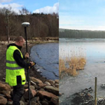 Standardized prototype drawings provide more efficient flow for Hovås Mätkonsult
At Hovås Mätkonsult, one has developed a standardized way of working, controlled by the prototype drawings presented in Topocad. This contributes to the flow of information in the projects”says Filippa Christiansen.
Fast growing GeoDeal uses Topocad for quality checks
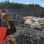 The pace is high at the engineering company GeoDeal. To achieve good quality in data input from the field, Topocad is used. It has become a daily routine at the company.
– It is unusual how many file formats Topocad can read, says Frederick Håkansson, CEO.
Topocad is a software that adapts to the user
T
 o work effective, the software needs to keep up with the technical development and be able to handle large amounts of data. That is one of the reasons why the region manager at Teodoliten Mätteknik, Ali Afsahi, has chosen to work with Topocad. The software adjusts to the way I think, he says.
When a connecting line must be designed one can study which points that are best suited in Topocad
Niklas Åberg, Surveyor, LKAB

This is one of the major uses and benefits I have by using Topocad
“I
 have worked in many major projects and the only way to be successful is to have a simple, logical and functional structure. We must by controlling the process, which is one of the major uses and benefits I have by using Topocad”
Peter Landau, Measurement manager, NCC
Topocad gives me an opportunity in the point cloud module to analyze points and assess their value
 Glenn Karlsson, Head of Department East, InfraGeoTech
More articles:
A new country in need of new data – Topocad in Tajikistan
“The layering structure in Topocad became very complex during this project, as there was so much interesting data. Some layers contain scanned older Soviet maps based on aerial photographs showing, for instance, collective farms and irrigation systems.”
“We wouldn’t manage without Topocad”
Joakim Sköld, a survey technician at SVEAB, has used Topocad for almost four years. Topocad is one of his most important tools.
SVEAB is a full service company that handles commissions of great variety. In one of their latest projects their assignment is to build a passage for pedestrians and cyclists under the railroad at the Central station in Uppsala, Sweden. This project is part of the Travel center Uppsala. The work began in February 2006 and is scheduled to finish in March 2010.
– I use Topocad daily for volume calculation and control of quantities and areas, says Joakim Sköld.
Interested in something particular?
A large amount of case studies are avaliable in different areas, please contact us for further information.