-

Satellite images as a mapping tool even when the jungle is dense and it’s often cloudy
Read our story about surveying in Indonesia!
Indonesia, with more than 270 million inhabitants, is on its way of becoming one of Asia’s star economies. While the economy is booming, there is a great need for support and development on the countryside. One example is in the province of Riau, on the island of Sumatra, where mapping of district boundaries should give six districts a better control and help to prevent a too quick and incorrect disforestation.
One of the external lecturers at Topocad Live 2020, in January, was surveyor Thomas Dubois from the educational company Kartotek AB. He took the audience on a journey far away, to an exciting project in a very different environment. On the topic “How do you map hard-to-reach areas such as the jungles of Indonesia?”, Thomas talked about a culture and nature which gives a whole new dimension on which challenges that can be faced when mapping boundaries and producing maps.
Want to counteract an uncontrolled felling
The project where Thomas was hired as a technical advisor for periods during 2017/2018 was included as one of eight sub-projects in the MCA – Millennium Challenge Account. Principals of the program is the Government of Indonesia together with the Millennium Challenge Corporation (MCC) in the United States, which is an independent bilateral authority formed by the US Congress in 2004. One of the goals of the MCC is to provide support for projects working against global property. In Indonesia, this is done through investments in economic growth and they are implemented with a focus on climate and environmental aspects. Thomas’s subproject was called Participatory Mapping and Planning (PMap 8) with the addition “Green Prosperity”.
The background of the project was the need of having a better control of the district boundaries for the province of Riau. This is to counteract an overly rapid and uncontrolled harvesting of both companies and private individuals, but also to lay the groundwork for a more efficient organization in the districts. Deforestation is a major problem in Indonesia. Some of the felling is illegal while other felling is done to make room for agriculture and oil palms. Palm oil is a lucrative crop as it provides good yield for an, otherwise, poor population.
The Finnish branch of the company Niras was the principal of the project, and together with the Indonesian company Sekala, they were also responsible for the implementation of the project.
– The task was to carry out a mapping of district boundaries, with satellite imagery as the main tool, in the province of Riau on the middle part of the island of Sumatra. The province is divided into ten districts and parts of six of these were included in the project. Riau has an area of over 88 000 square kilometers and the project area covered 5 000 square kilometers. That some parts of the districts are dense jungle without road networks was just one of the challenges, Thomas says.
Another challenge was that the project area was in the middle of the equator. As many already know, the coordinate system starts at the equator, but what happens below the equator was a question Thomas asked the audience. He explained himself and without delving into the details we quickly realized that the equator through the project area was troubling and resulted in a lot of extra work.
There are tigers on the often-cloudy Sumatra
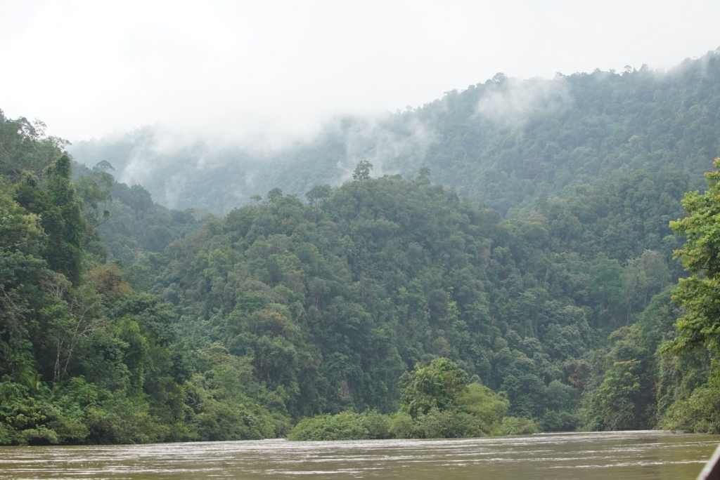
The participants at Topocad Live could, through Thomas’s story, pictures and a couple of films, form an idea of the beautiful but also demanding nature of Riau. Large plantations with infinitely long rows of oil palm trees and in other areas dense jungle with river canoes as the only alternative of a transport. The project brought Thomas to many exciting places and although the idea of Sumatra tigers being there by the field work, he was never worried. Still, there are an estimated number of between 400 and 500 tigers on Sumatra, but the areas where they move are large. Sumatra has an area of 425 000 square kilometers (much like Sweden) and is the world’s sixth largest island due to surface.

A glance at the sky at Sumatra may be enough to understand what makes it difficult when mapping boundaries by collection images and image interpretation.
– It’s often cloudy on Sumatra and it was one of the biggest problems we had to contend with. We solved it by ordering satellite images for a certain area from about the same time period, looking at which pictures had slightly less amount of clouds or no clouds at all, and then combining the images. In the end, we were able to piece together pictures that were not completely perfect, but still good enough, Thomas explains.
The images were ordered from different satellites based on several specifications such as area, cloudiness, time of year and resolution. Thomas showed examples of pictures with 10 meters resolution (not enough to map with!), 25 cm and drone pictures with 10 cm resolution. In the beginning, it was assumed that it would be enough if the images had a resolution of 3 meters to be able to draw the district boundaries. However, Thomas was able to show that images with better than 80 cm resolution were required. It was simply necessary to be able to see enough details and identify the location! Boundaries which did not appear in the satellite images were then inventoried in the field by survey teams who traveled to the villages in the districts. The discussions could be lively, but they always came up with a solution what everyone accepted.
A gigantic country with a dress code of its own
Thomas told us two things about Indonesia that may have surprised many people in the audience. One is that Indonesia is a very large country and considerably larger than most people think. From east to west, this island nation with more than 17 000 islands and 33 provinces is approximately 5 300 kilometers wide. “It’s as far as the distance from Sweden down to Ethiopia”, Thomas said while showing on a world map. The second thing is the dress code which differs from the one we have in Sweden at business meetings, for example. In Indonesia, it’s not the jacket or suit that applies to the men. To illustrate this, Thomas surprised everyone by taking his shirt of and exposing what in Indonesia is called the usual “suit”. Thomas continued his story wearing a short-sleeved batik shirt.
– Indonesia is a country with an exciting and different culture. An example is the dress code. I became aware of this when I met the project manager. I probably expected a suit, shirt and tie. That was not the case at all. At slightly more formal meetings, you have long-sleeved batik shirts instead, and at work meetings it’s usually short-sleeved. You can think much about the look and colors of these shirts, but you get used it quickly and they are also very comfortable, Thomas says with a smile.
Big meetings, a strong hierarchy and a lot of field work
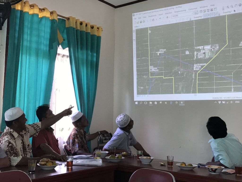
The newly purchased batik shirt soon benefited Thomas. During the project, meetings were held where district and provincial representatives gathered to jointly look at satellite images, discuss these and exchange views. Thomas talked about a very strong cultural as well as administrative division. A key to the work’s progress was that a royal person (radja), who attended a meeting Thomas was participating in, gave his approval. Although the radja doesn’t have an administrative role, his approval was a prerequisite for decision makers and other stakeholders to support the project.
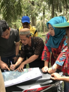
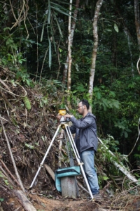
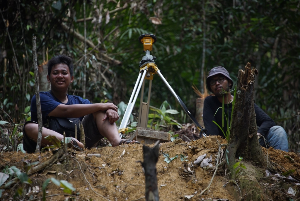
A time-consuming part of the project was location rectification and georeferencing of satellite images with measurement of flight signals (known points in the images) as part of this process. Also in the jungle, flight signals must be measured with GNSS and Thomas explained that field team members sometimes must climb trees and cut openings in order to receive the satellite signals. GNSS baselines were then calculated using RTKLIB Open Source software. The project work eventually resulted in more than 500 map prints to be studied in the districts and approved by the district managers. In some cases, changes were required, but eventually all inscriptions were in place. However, the mission was not quite over yet. The fact that each district also wanted to have several physically located district boundary points resulted in the survey team having to go out in the jungle, once more, for new measurements.
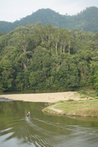
For Thomas, the project in Indonesia means that he can add another large foreign assignment to his track record. He has previously worked in a multi-year aid-funded map project in Ethiopia. That project had its own special technical challenges, just like the one in Indonesia. The mapping on Sumatra shows that satellite images today are sufficiently detailed and so easily accessible that they can become important tools in difficult-to-access and sparsely populated areas where the need for local development as well as climate and environmental improvements can be great!
Ten things you may not know about Indonesia
- The country has the world’s largest Muslim population. Out of 270 million inhabitants, approximately 225 million of them are Muslims
- There are more than 300 ethnic groups
- The official language is Bahasa Indonesia, but another 700 languages are spoken regularly by the many ethnic groups
- Over 50% of the country’s area is covered by forest
- There are 17 504 islands and 6 000 of these are uninhabited
- There are 127 active volcanoes
- In the jungle there are about 100 tribes who haven’t had any contact with civilization
- Indonesians are the shortest in the world, with an average length of 158 cm
- Every year, approximately 3 000 tonnes of frogs are exported to France
- Indonesia is the world’s largest producer of palm oil
-
More news
-

Topocad 23.2.1 is here!
The latest version of Topocad, 23.2.1, is now available! This update brings enhanced support for various URL formats in WMS services, the new database adapter for ArcGIS Pro now supports circular Arcs, along with numerous other improvements.
Click here to download
Discover all the new features here
Read more -

Adtollo Inside Story: Meet Axel Munktell, Topocad Sales Representative at Adtollo
Name: Axel Munktell Position: Sales Representative, Topocad Employed at Adtollo since: Spring 2023 Background: Recently graduated Bachelor of Science, Industrial and Management Engineering at Örebro University.
Meet Axel, our enthusiastic newcomer to the Adtollo family. Growing up in Alsike, Knivsta, Axel spent four years studying in Örebro before making the move to Stockholm to join...
Read more -

Explore Topocad 23.2: What’s New and Improved!
Discover Topocad 23.2: Packed with new user-friendly features!
Download version
All version news
In this brief video, you can watch Amanda demonstrate the latest news in Topocad 23.2. We have made adjustments to the settings window for point information, introduced a new method for gross error adjustment, and now, when calculating survey data, you have the option to exclude backsight...
Read more -

Topocad 23 is released!
Topocad 23 is the latest version of our popular software for surveying, mapping and design. With new features and improvements, Topocad 23 offers even more possibilities for efficient work and quality results.
At Adtollo, we are proud to continue developing Topocad to meet the needs of our customers. We believe that Topocad 23 will be a valuable tool for surveyors, engineers, architects, and other...
Read more -

Release of Topocad 22.2!
Topocad 22.2 is released!
Watch the video where Jakob demonstrates some of the big news in Topcoad version 22.2, such as digital terrain model (DTM) handeling, import of LandXML, DXF/DGW, and IFC.
Also, a new camera control and input alternatives.
WATCH VIDEO
Read more